


In May of aught-one, Jack Gartside, Dale Linder, and Mike Quigley (your humble author) took a ten day road trip through Mexico's Yucatan peninsula. No lodges, no guides, no set itinerary. Just three guys in a rental car with a trunk full of fly rods, driving around looking for fish. What follows is a photo journal of the trip, divided into three pages:
Page 1: Xcalak - Pescadores Interuptus
Page 2: Chetumal Bay - The Road to Nowhere
Page 3: Boca Paila - Things Get Better
Page 1: Xcalak - Pescadores Interuptus
 We
arrived in Mexico on April 28, with 8 fly rods, an inflatable boat, two
bags of pistachio nuts, and a one month supply of Ramen noodle soup. After
spending a night in Tulum (where Jack and Dale went, in Jack's vernacular,
"bun fishing"), we drove to Xcalak, a small fishing town 300
kilometers to the south near the border of Belize.
We
arrived in Mexico on April 28, with 8 fly rods, an inflatable boat, two
bags of pistachio nuts, and a one month supply of Ramen noodle soup. After
spending a night in Tulum (where Jack and Dale went, in Jack's vernacular,
"bun fishing"), we drove to Xcalak, a small fishing town 300
kilometers to the south near the border of Belize.
Why Xcalak? Well, it's remote, a place we'd never been, and we'd heard vague references to good fishing there. Basically, we just looked at a map of Mexico and picked the most remote spot we could find.
The route south to Xcalak passes through 150 miles of tangled green country, interrupted only occasionally by orange groves and ancient villages. At its end we found a small weathered town, populated with nice people, bordered by beautiful water in which we caught very little. In short, Xcalak was a place where all the conditions looked right, but where the fish failed to materialize.
To be fair, I should note that we only fished Xcalak (it's pronounced ("Shka-lak") for four days, and that we pointedly ignored suggestions to hire a guide; on a Gartside expedition, one survives on one's own skills, going fishless if necessary. Hiring a guide is considered both decadent and an admission of failure — akin to having a pizza delivered while scaling Mount Everest.
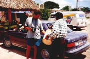 Stopping
for Gas
Stopping
for Gas
...on the way to Xcalak. It's 3 hours from the nearest Pemex station (the official gas station of Mexico) to Xcalak. Still, if you're willing to pay a little extra, and you don't mind it poured from a bucket, there's gas to be had along the way.
While you can't see it, the guy pouring the gas has a lit cigarette hanging out of his mouth (I think he must have been Jack's long lost brother). Another thing you can't see is me walking backwards as I take this picture.
 Windmills
The first thing you notice when entering Xcalak are six large windmills (not very visible in this picture). Xcalak is far from and unconnected to any power stations. Its electrical power comes from the wind (via the windmills) and the sun (via solar panels). In theory, a cloudy, windless day could leave the town without electricity, but there aren't many of those.
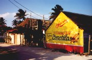 The
Best Joint in Town
The
Best Joint in Town
We'd heard Conchitas was the best restaurant in town (there are only 3). Unfortunately, it was boarded up when we were there.
In the 1950s, Xcalak was the biggest town in Quintana Roo province, bigger than Cozumel, Playa del Carmen, and Cancun. But a series of hurricanes in the 1960s wrecked the town's industries (mostly copra — a fiber derivative of palm trees) and led to eventual depopulation. Today the population is around 300.
 Wasting
Away in Palapaville
Wasting
Away in Palapaville
The hotel district in Xcalak consists of about 8 small establishments strung along the coast north of town. Most are run by expatriate Americans and Europeans.
Because of the spectacular reefs off Xcalak, the hotels cater mostly to divers. Flyfishermen are something new (Note: divers are not early risers — and are grouchy when you inadvertantly wake them at 4 a.m.)
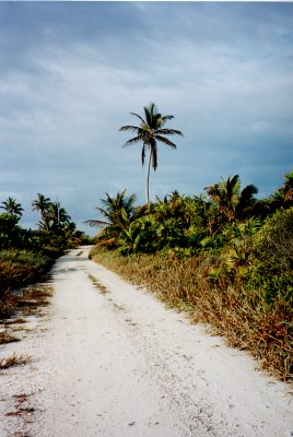 The
Old Coast Road
The
Old Coast Road
A deep-rutted dirt road runs along the coast north of Xcalak. Years ago it was the only road into town, connecting Xcalak to Majahual 60 kilometers to the north. Each morning, for the first 3 days of our visit, we headed up this road. With cups of instant coffee in hand, we bumped our way along, watching the sun rise out of the ocean, and scouting for bonefish.
Most days we encountered a military patrol, with whom we shared our breakfast of oranges. Nice guys. One even took a picture of us, which has probably since been developed and labeled El Dorko Pescadores.
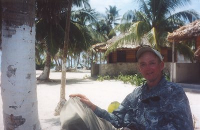
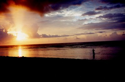 Sunrise
That's Dale in the foreground, casting to bonefish on a firm-bottomed grass flat. In the distance, you can see the coral reef that runs all along the Xcalak coast. In most places the reef is about a mile off, though we found a few spots where it comes within a few hundred yards of the shore. Due of the reef's protection, there is very little surf along the Xcalak coast — the water is for the most part calm and clear.
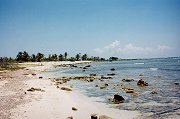 The
North Coast
The
North Coast
The coast north of Xcalak is beautiful and deserted. There are miles of broad turtle grass flats and occasional small rocky bays. We saw permit, cuda, and small schools of bonefish. After several days of trying though, all we had to show for our efforts were some small jacks, snappers, and a few skinny barracuda.
 Rio
Hauch
Rio
Hauch
15 kilometers north of Xcalak the road crosses a small river named Rio Hauch (pronounced "watch"). It looked like a good place for tarpon, but we didn't find any. At the mouth there are broad expanses of pristine grass flats, dotted in places by sandy rises. It looked perfect to us, but where were the fish? Signs of recent gill nets may have provided a clue.
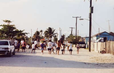 A
Volleyball Game
A
Volleyball Game
...temporarily closes the main street in town.
Except for the palm trees and soldiers with automatic weapons, Xcalak looks like a town straight out of Huckleberry Finn. The local people are friendly and physically very attractive — bright eyed and clear skinned. Surprisingly, many of them speak very good English (perhaps due to the close proximity of Belize). Most locals earn their living diving for conch and lobster. Net fishing is — officially anyway — illegal.
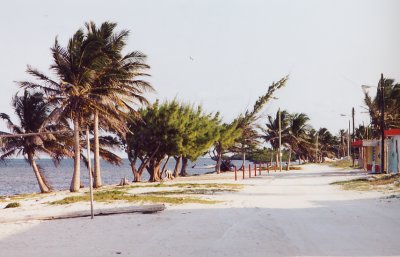 South from Town
A smooth sandy road runs south from Xcalak, ending 8 kilometers later at a new channel dug several years ago by the Mexican navy. Access to the channel is restricted — not even the locals know why. We set out to fish there one afternoon, but chickened out when we encountered a compound complete with troops, barbed wire, and gun emplacements.
A little farther south from the new canal is the OLD canal — Bacalar Chico — dug by the Mayans a thousand years ago to connect Chetumal Bay to the ocean. Bacalar Chico now forms the boundary between Mexico and Belize.
- Pescadores Interuptus
